Damage in Waveland & Bay St. Louis
Sorry I’ve been so long in posting the pictures of Katrina’s damage to the Mississippi Gulf Coast. My phone service and internet service was out for quite a while and I’m just now getting my pictures up. When Katrina came ashore on August 29, 2005, it centered on Hancock County. Bay St. Louis, Waveland and Pass Christian got the brunt of the storm. I spoke to people who had as much as 10 feet of water in their homes. Some people only have slabs to show they even had a home. The pictures you’re about to see were taken in Waveland and Bay St. Louis, Mississippi. To be honest, I’m not very sure where Waveland ends and Bay St. Louis starts so please accept my apology in not identifying the proper town.
These first pictures were taken going down highway 603 from Kiln toward highway 90 in Waveland.
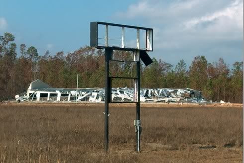
First, this used to be a ministorage. It looks like a giant foot (ala Monty Python's Flying Circus) crushed it.
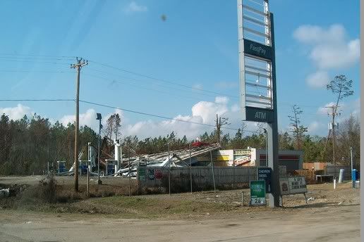
It'd be pretty hard to buy gas from this station...
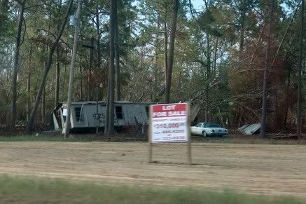
And I wonder if these people will succeed in getting $310,000 for their property?
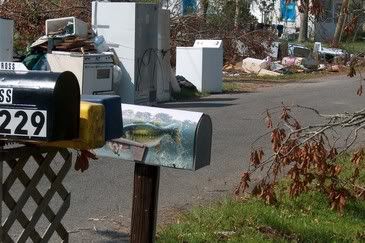
Following the storm the people in this neighborhood had to bring all their belongings out to the side of the street for pick up. By the time I made it down there it had been there a good three weeks since the storm. The refrigerators were taped shut by duct tape and had the words “spoiled meat” written on them. The stench was unbelievable. And you can see how close to the street the houses were. Most of the houses were uninhabitable but people were living in tents, and some lucky ones had received their FEMA travel trailers, set up in their yards. It’s hard to imagine having to live with this, but everyone I met, no matter their race or economic status had the same “we’re gonna get through this” attitude. My hat’s off to ‘em!

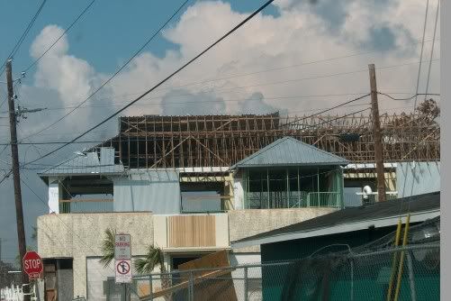
This building is in Bay St. Louis. It obviously has major structural damage...
These are pictures of what's left of highway 90's bridge over the Bay of St. Louis:
"End of the Road"
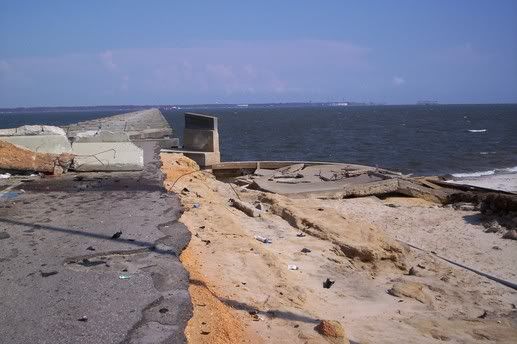
Straight on view:
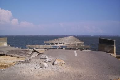
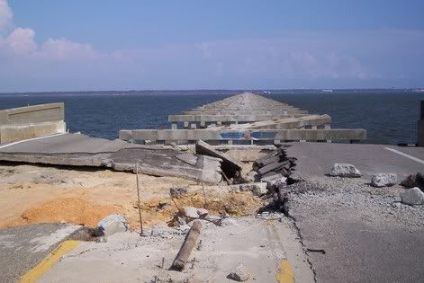
It's hard to see, but this is the side view. All that's left are the supports:
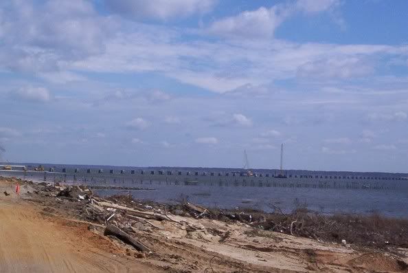
The following used to be home sites near the Bay. The first two are of a place where the home owners lost everything except their sense of humor:

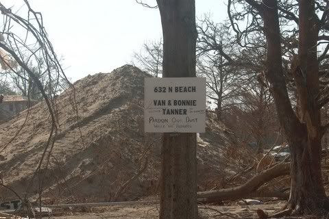
The sign says, "Pardon our dust while we remodel."
This is turning down the drive along the Bay. Remember, people used to live all along the left side of the road.
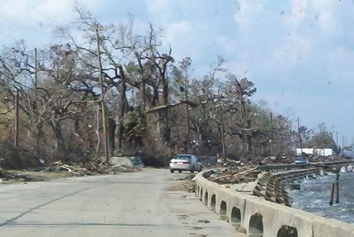
The next pictures were taken down in this area. Mostly just slabs where homes once were and others look like the house was washed out from under the roof.
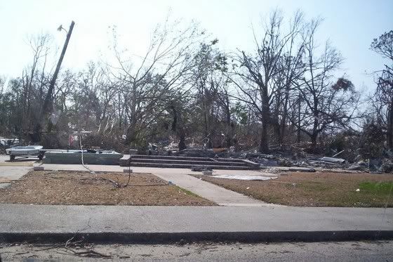


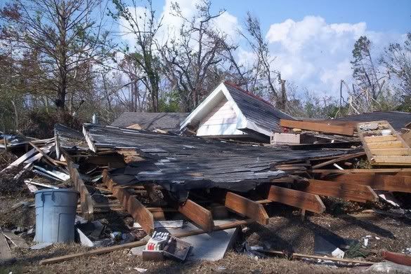
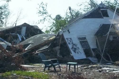
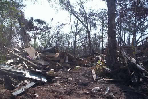
When Katrina had passed and I went out to survey the damage around my place I knew I had been greatly blessed. Trees were down everywhere and roads blocked to the point that it took nearly two days working with chain saws just to get out. But there was no real damage to my house! I also was thinking "If things look like this where I live, about 40 miles inland, what does it look like on the Coast?" Well now we know.
Please keep the folks there in your prayers. People from all over are coming down and helping out; cleaning up and bringing aid, and I thank God for them.
Next I'm going to show you what I've had the opportunity to do on my visits to the Coast. In the meantime, God bless and keep you all!
These first pictures were taken going down highway 603 from Kiln toward highway 90 in Waveland.
First, this used to be a ministorage. It looks like a giant foot (ala Monty Python's Flying Circus) crushed it.

It'd be pretty hard to buy gas from this station...

And I wonder if these people will succeed in getting $310,000 for their property?

Following the storm the people in this neighborhood had to bring all their belongings out to the side of the street for pick up. By the time I made it down there it had been there a good three weeks since the storm. The refrigerators were taped shut by duct tape and had the words “spoiled meat” written on them. The stench was unbelievable. And you can see how close to the street the houses were. Most of the houses were uninhabitable but people were living in tents, and some lucky ones had received their FEMA travel trailers, set up in their yards. It’s hard to imagine having to live with this, but everyone I met, no matter their race or economic status had the same “we’re gonna get through this” attitude. My hat’s off to ‘em!


This building is in Bay St. Louis. It obviously has major structural damage...

These are pictures of what's left of highway 90's bridge over the Bay of St. Louis:

Straight on view:


It's hard to see, but this is the side view. All that's left are the supports:

The following used to be home sites near the Bay. The first two are of a place where the home owners lost everything except their sense of humor:


The sign says, "Pardon our dust while we remodel."
This is turning down the drive along the Bay. Remember, people used to live all along the left side of the road.

The next pictures were taken down in this area. Mostly just slabs where homes once were and others look like the house was washed out from under the roof.


When Katrina had passed and I went out to survey the damage around my place I knew I had been greatly blessed. Trees were down everywhere and roads blocked to the point that it took nearly two days working with chain saws just to get out. But there was no real damage to my house! I also was thinking "If things look like this where I live, about 40 miles inland, what does it look like on the Coast?" Well now we know.
Please keep the folks there in your prayers. People from all over are coming down and helping out; cleaning up and bringing aid, and I thank God for them.
Next I'm going to show you what I've had the opportunity to do on my visits to the Coast. In the meantime, God bless and keep you all!


0 Comments:
Post a Comment
<< Home